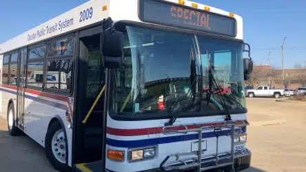
June 25, 2025 – The City of Decatur has announced that Decatur Public Transit is now available on Google Maps, giving transit riders real time updates.
With Google Transit, users can view Decatur’s public transportation options within Google Maps to help them plan the best routes to get where they’re going.
“We are excited to pass another important milestone toward better serving our riders and our community,” said City Transportation Director Lacie Elzy. “Google Maps is one of the most widely-used map applications so having Decatur Public Transit data available will only help us expand our reach and provide more real-time information.”
To view real-time public transportation options on Google Maps, open your Google Maps application or go to a browser. Input your destination, select get directions, then swipe over to or click on the public transport mode of travel. You’ll see DPTS bus route options, their scheduled departure and arrival times, and the price of the trip.
Additionally, the City is preparing to launch microtransit services starting in 2025. These routes will also be integrated into Google Transit, which will significantly increase DPTS’s footprint beyond the fixed-route buses. Microtransit operates similar to ride share services, utilizing a range of smaller vehicles to pick up riders from assigned stops and take them to assigned stops near their destinations.
